
We have a newly issued severe thunderstorm watch in effect for the WLFI viewing area until 9:32pm EDT. Remember in my last post we talked about how there could be a pop up thundershower in the area this afternoon / evening. Well this is what that watch is issued for. Take a look at the radar below. You can see some thundershowers starting to form along that cold front to our west.
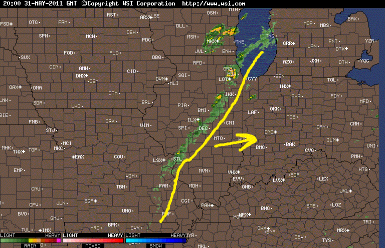
We will watch this closely just in case any storms start to become severe. Currently none of these storms to our west are severe warned which is good news! However we are currently unstable enough to support a quick stray strong storm or two within the WLFI viewing area.

Above you can see we are looking at current Lifted Index between -6 and -7 which is rather unstable. Also below we have EHI values around 1 and 2 which would support thunderstorms as well.

So because of this we will continue to watch the data closely overtime along with the radars. If I see any changes I'll be sure to let you know. Also if things get stormy I will be on the Live Chat keeping you posted as well.
No comments:
Post a Comment